DSOutdoors
Expedition

Alaska "Farthest North" Backpack Trip

Arctic NWR, Alaska · June 2001
12
Galleries
219
Photos
About This Trip
The Team

This 12-day backpack trip was run by as a national outing (Trip #01022). Leaders were Carol Hake and Drew McCalley, both veteran leaders of Alaskan backpack trips. Carol has led this trip eleven times - no mean feat considering she celebrated her 71st birthday during this trip! Way to go Carol! Drew is returning for his eighth trip to the North Slope of the Arctic Refuge, and clearly delighted in sharing his knowledge and expertise of the area with others. The 10 participants came from across the country, and were all experienced backpackers, coming together to share our appreciation of the still-pristine arctic wilderness, and our desire to preserve it.

The Route — Day by Day
fly from fairbanks to arctic village, then in a bush plane to the jago river valley
Distance: About 150 miles to Arctic Village, about 80 miles to Jago River. We flew in a 9-passenger Cessna Caravan from Fairbanks to Arctic Village, then in 3-passenger Cessna into the Jago River valley. Earlier groups out of Arctic Village were able to fly directly over the Brooks Range, however the clouds lowered later in the day and our flight went over lower peaks. We still had great scenery from the airplanes.
hike down the jago river valley to lake camp
Distance: 5 miles. Gain: 0’ . Loss: 300’ We hiked down Jago River valley on lumpy, grassy arctic terrain in warm, clear weather. We reached camp next to a beautiful reflecting lake at lunch time, and had time to explore up a ridge to 3190’ to see lots of wildflowers along with our first views of the Arctic Ocean and the white line of sea ice in the distance. We spotted our first grizzly bear foraging for food across the river, about a quarter mile away.
hike out of the jago river valley and around the corner onto the north slope into swamp camp
Distance: 8 miles. Gain: 0’. Loss 0’ We continued on relatively flat ground down toward the opening of the Jago River valley, then turned right over low hills to the edge of the North Slope. It became overcast as we settled into camp on a small creek . The original intended camp site was covered with ice, so we ended up in a slightly swampy area by the creek.
hike over ice and tussocks into fog camp
Distance: 7 miles. Gain/Loss: 600’ Dense fog surrounded us all morning and afternoon as we hiked across ice and over an endless ridge into another drainage. When we weren’t on ice, we were on deep tussocks and lots of water – typical Alaskan terrain!
traverse the north slope foothills to layover camp
Distance: 9 miles. Gain: 0’, Loss: 500’ Clear weather accompanied us for the hike along the edge of the North Slope, with nice views over the plains out to the Arctic Ocean. We spotted our first two caribou on the plains below us.
scramble up a nearby peak for great views
Distance: 3 miles. Gain/Loss: 1800’ The day started out overcast, then the clouds lifted a bit to above the peaks. Four of us “youngsters” climbed a nearby peak (about 3340’) while other groups explored up and down the river valley. On the climb, we had nasty, steep, sharp, loose slate for most of the way up, then a nice animal trail along the ridge at the top gave us some relief and good footing. At the top we had great views all around, and could see the Sadlerochit Mountains, Shublik Mountains, and the Brooks Range.
continue along the north slope and turn up the aichilik river valley into bear camp
Distance: 9 miles. Gain: 500’, Loss: 700’ We finished our crossing of the hills across the North Slope in cloudy weather, then it turned to rain as we descended to the ice-covered Aichilik River and turned up the valley. We saw a bear in the willow ahead of us, so we stopped for lunch to watch it. Then we proceeded on to camp as a blowing rain started pelting us, and picked up new supplies of food from a cache left in the area by our bush pilot.
follow the aichilik river up to beauty camp
Distance: 8 miles. Gain/Loss: 1800’ Snow flurries greeted us in the morning, then it became clear and windy as we climbed up a small pass to avoid cliffs over the river. We saw lots of caribou on the river bed and another grizzly bear on the horizon. We descended into beautifully located “Beauty Camp” with wonderful views of the ice-covered river and mountains.
leave the aichilik river valley and head up to moose camp
Distance: 8 miles. Gain: 500’, Loss: 0’ A rare clear morning was a welcome sight as we left the Aichilik River to follow a windy valley up to Moose Camp. Our course took us through lots of dense willow brush before we emerged at our campsite. Rain started up again in the evening.
climb over a pass and then down into high camp
Distance: 8 miles. Gain: 2000’, Loss: 500’ Light snow fell in the morning, then it remained overcast and became increasingly foggy as we headed up steeper, narrower canyons to a pass at 4000’, which ended up on a swampy bog! A short descent took us into High Camp in the fog.
descend the rest of the way down to the jago river valley
Distance: 4 miles. Loss: 1000’ Heavy snow starts up as soon as we get up in the morning, building up on tents to over an inch, then warming and clearing quickly as we descend into Jago River valley to camp just south of the airstrip. The warm and clear evening gives us a chance to dry out again.
fly out via arctic village back to fairbanks
Distance: About 80 miles to Arctic Village, then about 150 miles to Fairbanks. We get a beautiful clear day to fly out, and this time we fly directly over the high peaks in Brooks Range for spectacular views. The three of us on the first flight out got right on next plane out of Arctic Village for an early afternoon arrival back in Fairbanks. The rest of group made it back in the late afternoon, and we all had our last dinner together at the Thai House. The daily log written by trip members is available for downloading: Alaska Log.pdf

The Journey, Day by Day

Day 1 - Fly from Fairbanks to Arctic Village, Then in a Bush...

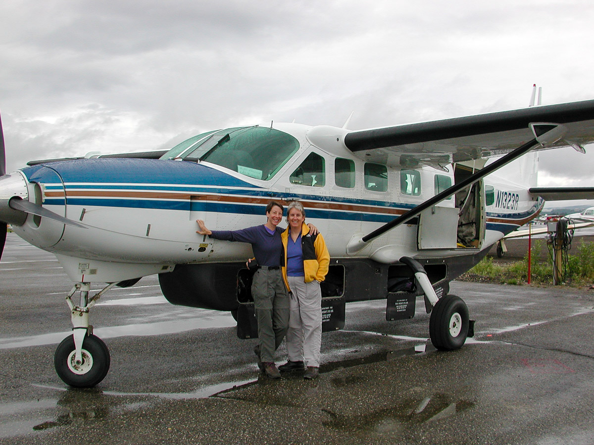
Two plane flights take us into the bush and offer us our first views of the amazing northern Alaskan terrain - which seems to consist mostly of water! (In frozen or liquid form.)

View Gallery → 24 photos
Day 2 - Hike Down the Jago River Valley to Lake Camp

A warm sun accompanies us on our short morning hike to a beautiful lakeside camp. After a brief afternoon rain squall, we still have time to explore up a ridge for our first glimpse of the expansive North Slope.

View Gallery → 14 photos
Day 3 - Hike Out of the Jago River Valley and Around the...

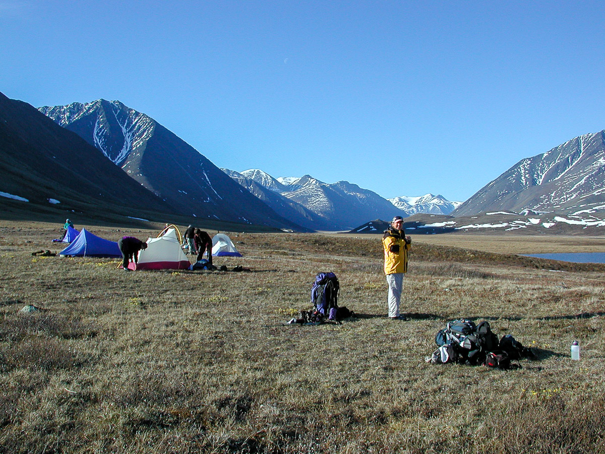
We leave the Jago River Valley and begin our excursion across the foothills on the edge of the North Slope, gaining beautiful views of the pristine, wide open arctic tundra, and we can see the thin line of arctic sea ice on the horizon.

View Gallery → 16 photos
Day 4 - Hike Over Ice and Tussocks Into Fog Camp

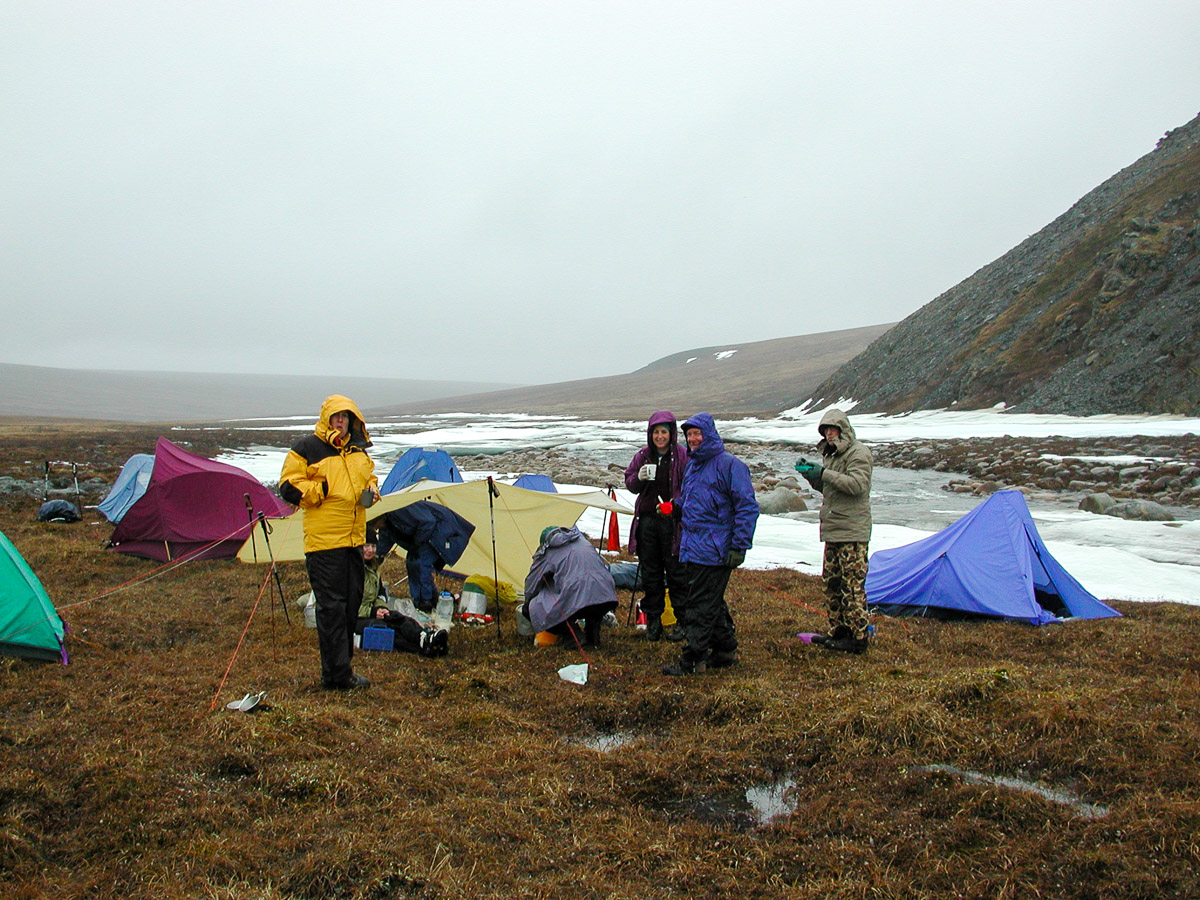
A foggy day doesn’t dampen our spirits as we traverse all types of terrain - crystaline ice, wet rocky creeks, and lumpy tussocks. The sun finally comes out after dinner to give us a chance to see and enjoy our surroundings.

View Gallery → 20 photos
Day 5 - Traverse the North Slope Foothills to Layover Camp...

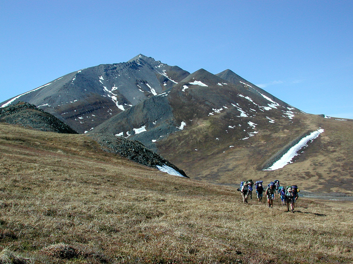
We continue bounding along the foothills below the North Slope under a clear blue sky - perfectly timed to give us wonderful views of the vast northern plains stretching out beside us.

View Gallery → 10 photos
Day 6 (Layover Day) - Scramble Up a Nearby Peak

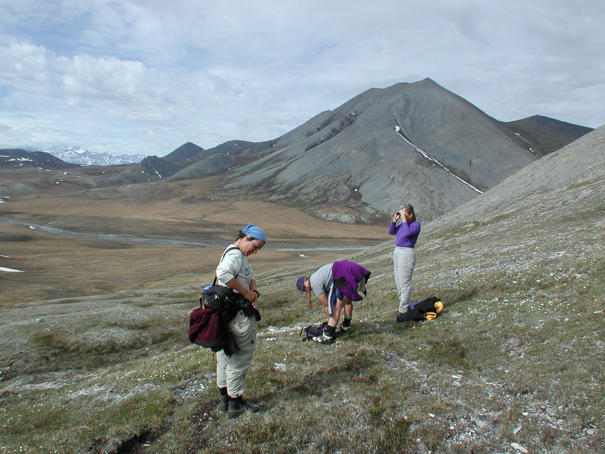
A free day and a nearby peak - nothing else to do but climb it! Four of us tackle the steep, unstable rocky slope to gain the summit and enjoy the amazing full 360° views! Two multi-image panoramas let you enjoy the same views.

View Gallery → 20 photos
Day 7 - Continue Along the North Slope and Turn up the...

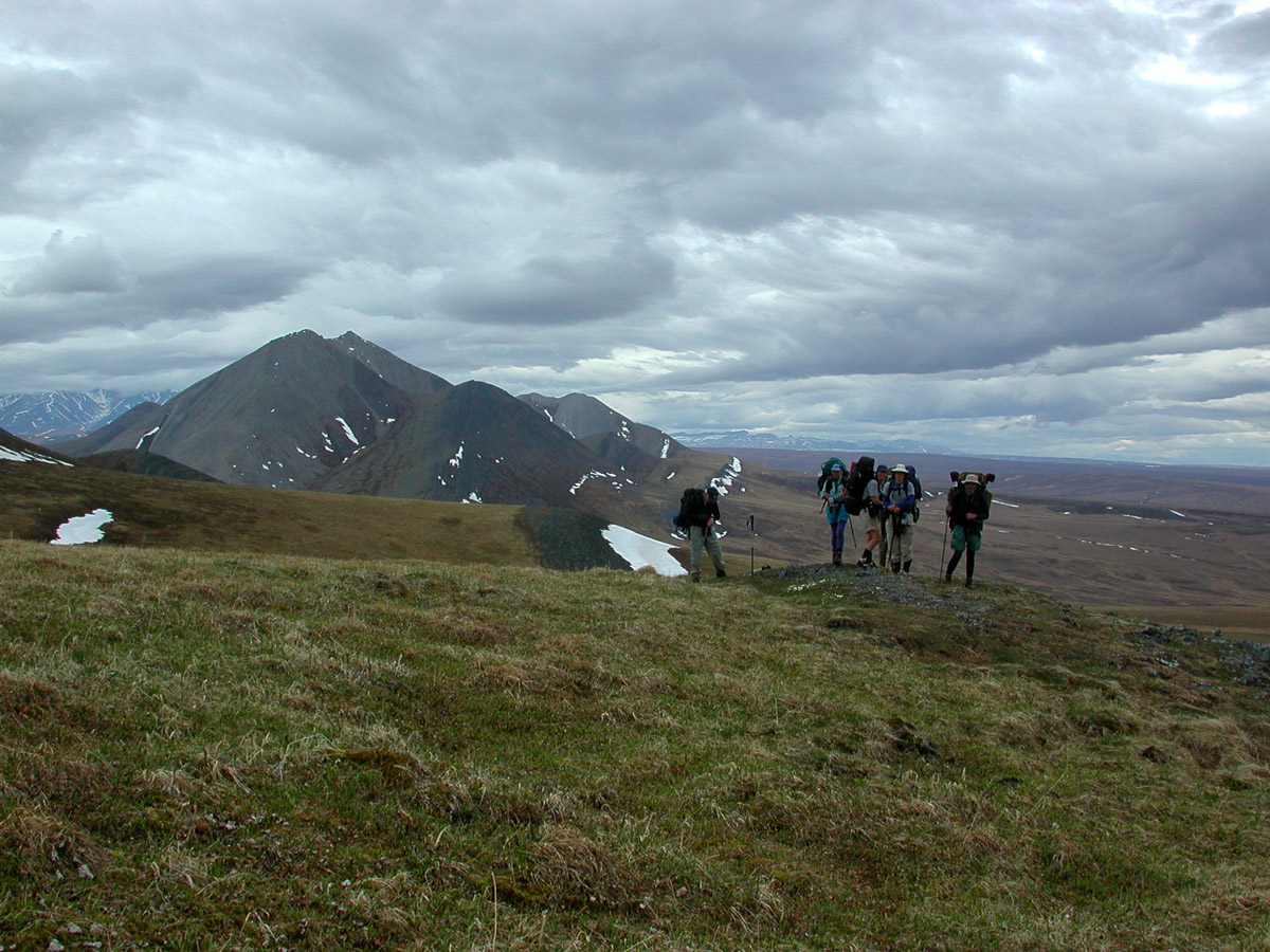
We finish our traverse of the North Slope foothills in driving rain, and gratefully turn our tails to the wind to head up the Aichilik River Valley. The food cache we pick up holds a welcome treat - some tasty rum - and the ensuing happy hour takes our minds off the weather.

View Gallery → 14 photos
Day 8 - Follow the Aichilik River up to Beauty Camp

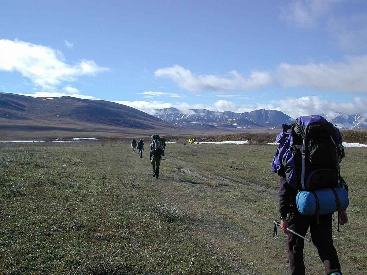
What more could we ask for today! Nice weather, a scenic climb over a low pass, and a spectacular location for our camp!

View Gallery → 24 photos
Day 9 - Leave the Aichilik River Valley and Hike Through...

The migrating caribou herd stream through the valley and across our path before we leave the Aichilik River to turn up a tributary and enter moose territory. We see lots of evidence of moose, but none in the flesh (sigh!), as we weave through dense willow before reaching our camp.

View Gallery → 25 photos
Day 10 - Climb Over a Foggy 4000' Pass and Descend into High...

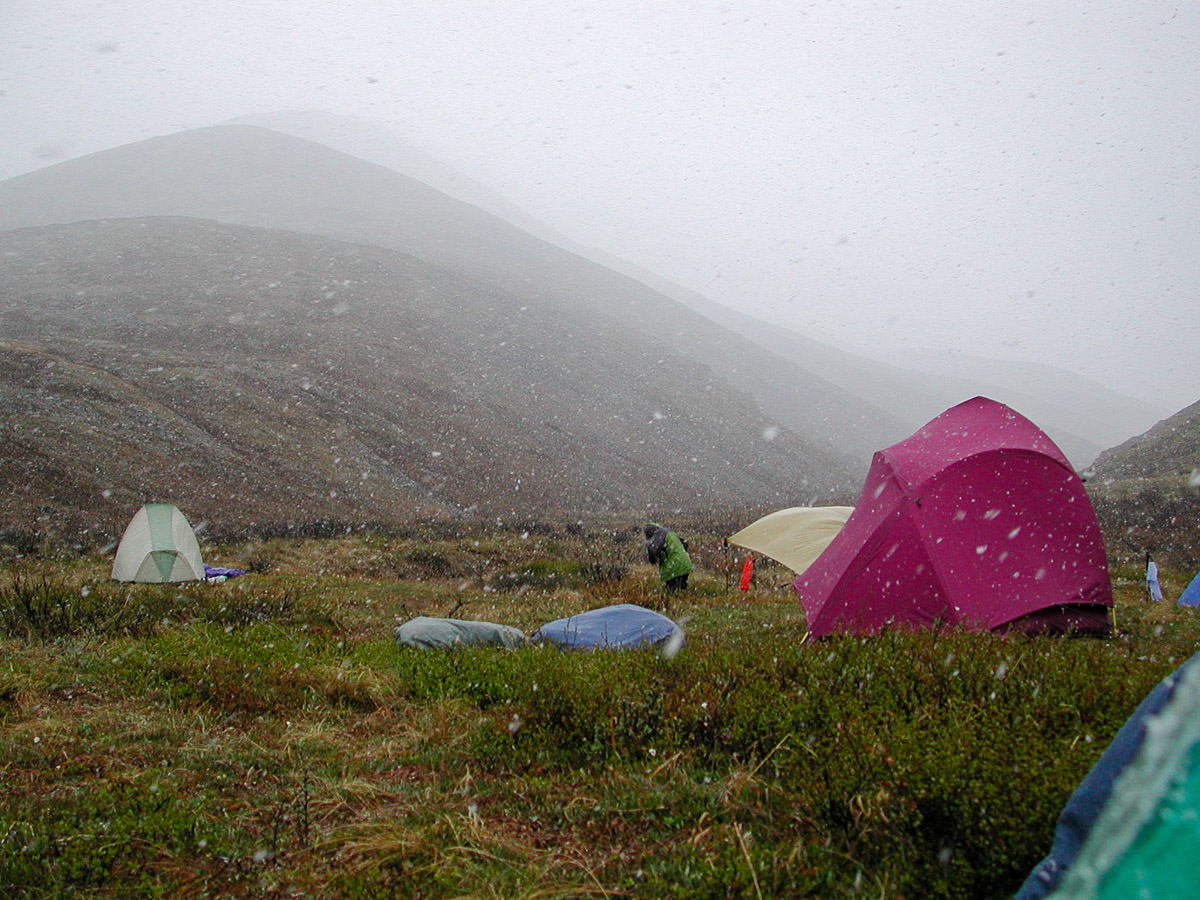
Despite thick snow in the morning, we climb our way up the constantly-narrower creek drainages into ever-thickening fog to our high point for the trip on a boggy 4000 ft pass.

View Gallery → 15 photos
Day 11 - Descend the Rest of the Way Down to the Jago River...

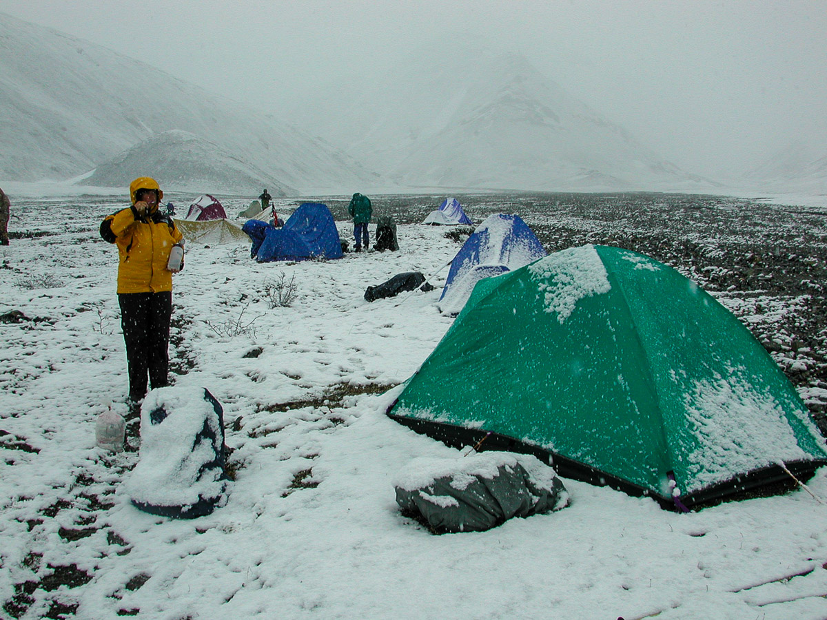
Another snowy morning turns into a warm, sunny afternoon, leaving us with beautiful views of snow-dusted hills all around as we descend back down to the Jago River Valley to return to our starting point near the airstrip on the Jago River.

View Gallery → 25 photos
Day 12 - Fly Out via Arctic Village Back to Fairbanks

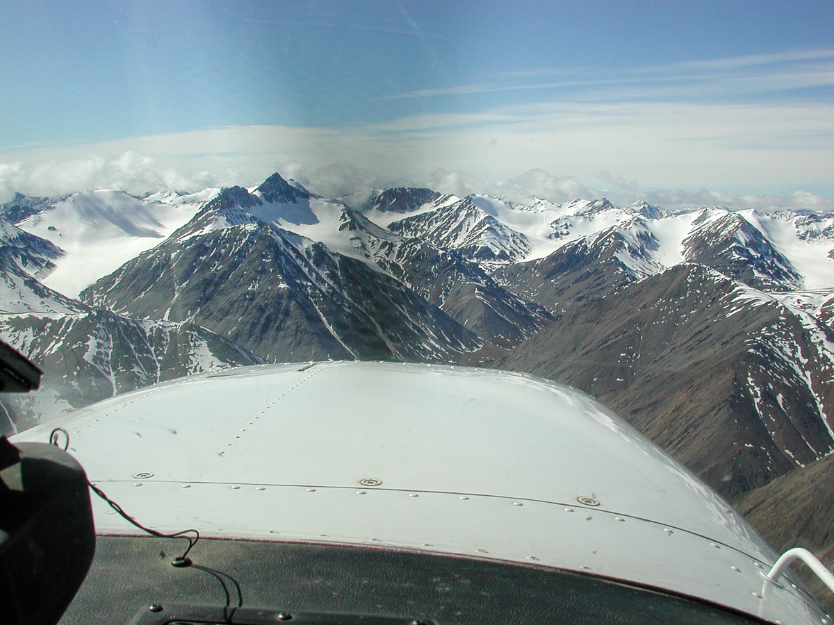
We fly right among the snow-capped peaks in the Brooks Range - so close we could almost touch them! - on our return from our memorable 12 days in the arctic wilderness.

View Gallery → 12 photos