Select a day
Day —
—
—
Start
—
End
—
High Point—
Trip Time—
Elev. Gain—
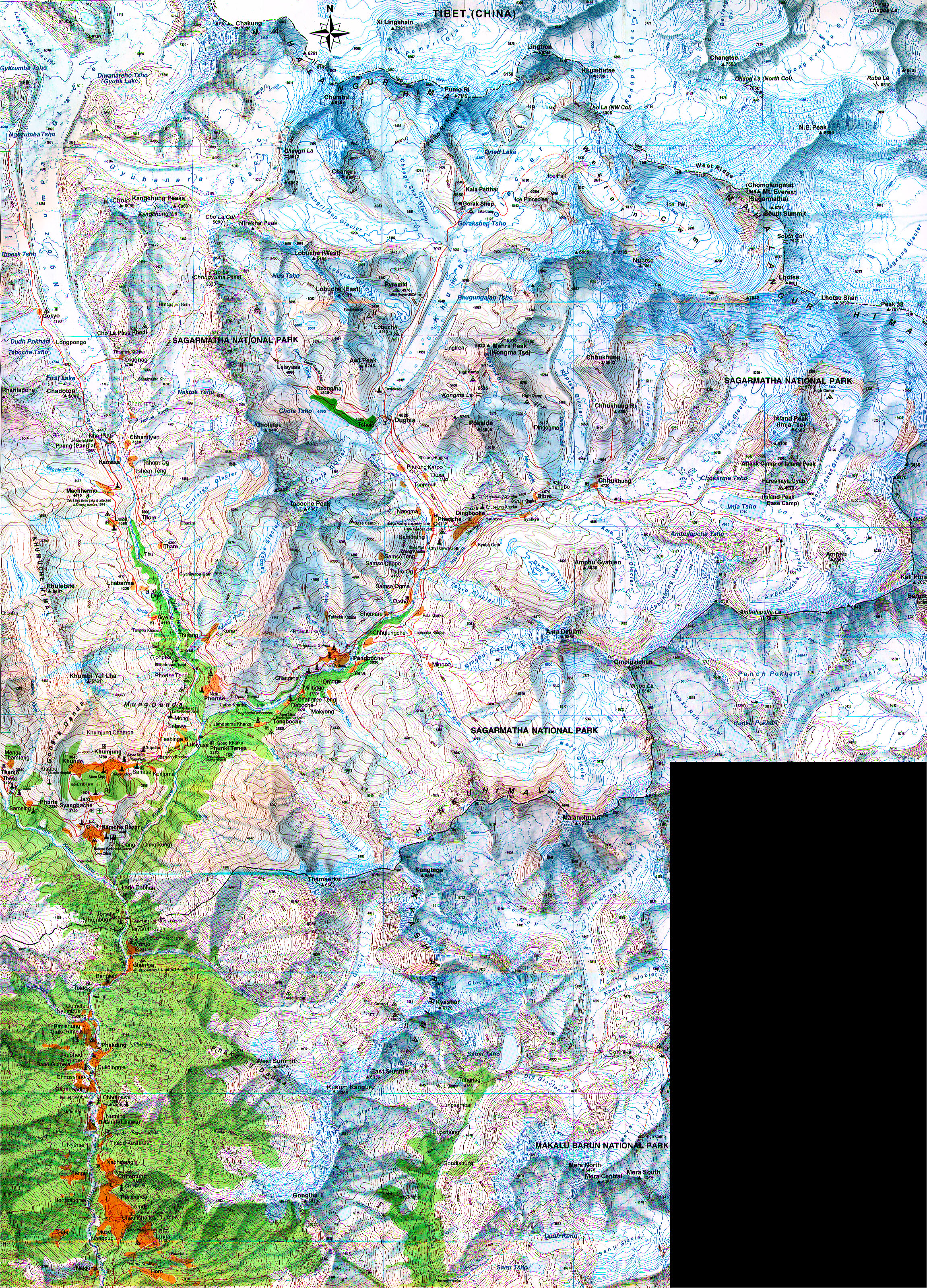
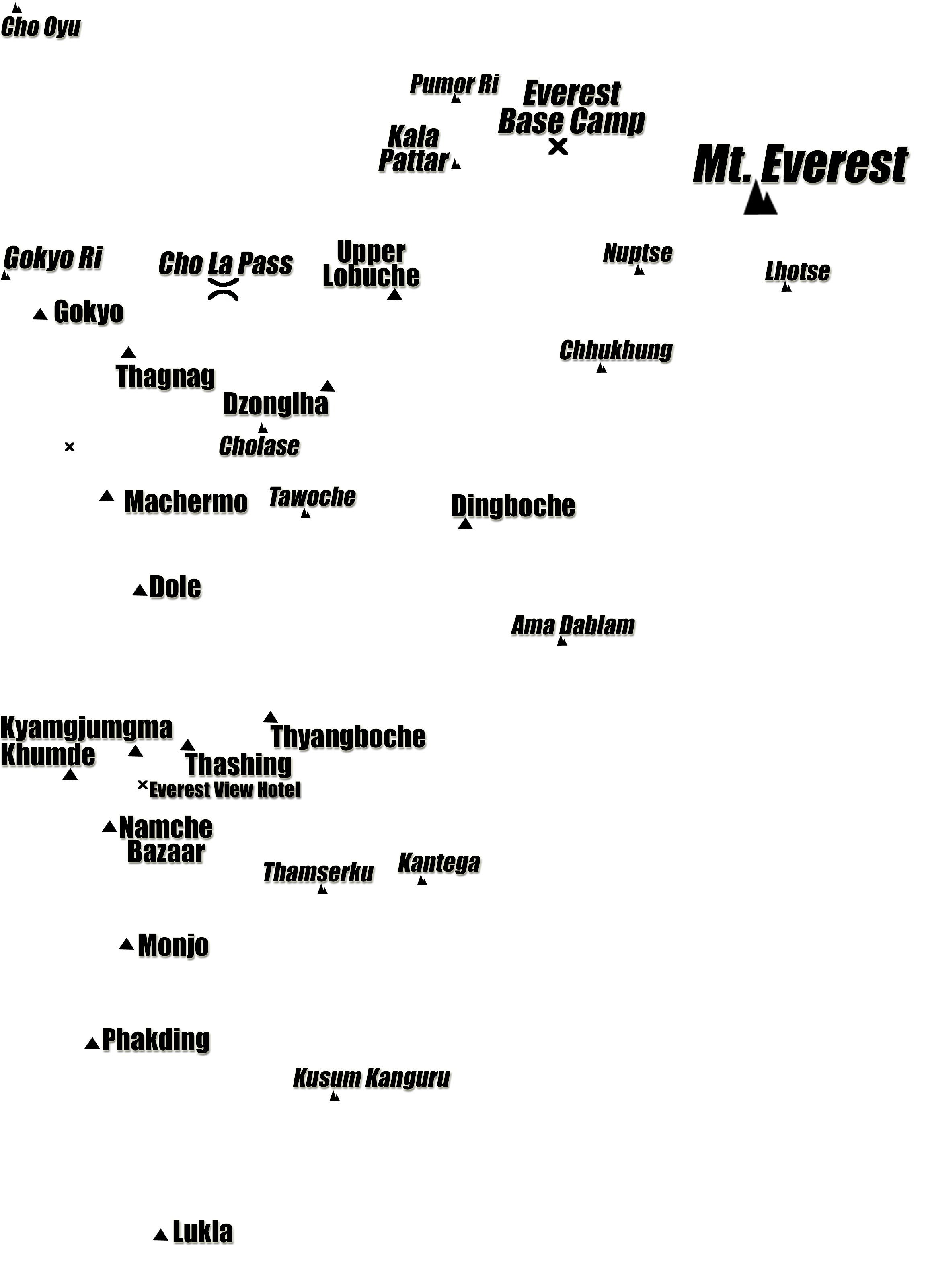
Khumbu Himalayas, Nepal · Dec 1999 – Jan 2000
The Route, Day by Day
Eighteen days through the Khumbu — Lukla to Everest Base Camp and back.
Elevation Profile
Cumulative trek hours along the bottom; elevation in feet on the left. Hover or click any day to highlight that segment.
All 18 Days
The trek follows the classic Cho La crossover: up the Dudh Koshi gorge to the Gokyo lakes, over the 17,780 ft Cho La pass, and into the Khumbu glacier valley to Everest Base Camp.
Four dayhike acclimatization climbs punctuate the ascent: Everest View Hotel (Day 3), Machermo Ridge (Day 7), Gokyo Ri (Day 9), and the high point of the trip — Kala Pattar at 18,490 ft on Day 13.
The return follows the main Khumbu trail back down through Dingboche and Monjo to Lukla — three days of descending through progressively warmer, greener terrain.